Cyclone Gabrielle
Impact Map
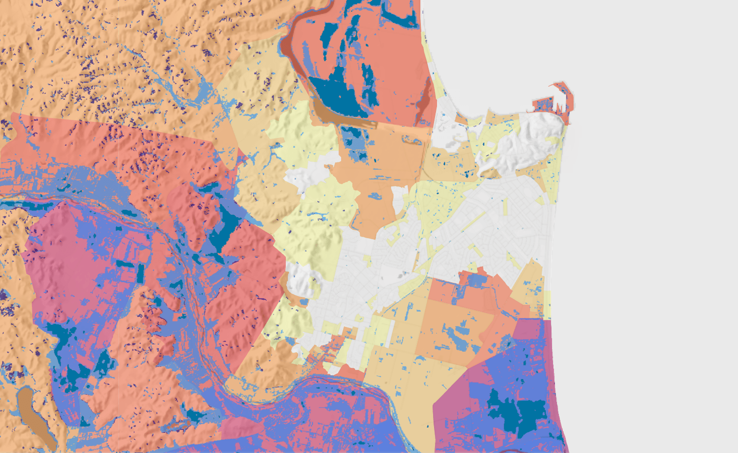
This map allows people to view the impact of Cyclone Gabrielle,
which hit the North Island over 13-14 February 2023.
The interactive map uses satellite data to visualise flooded areas,
deposited silt and slips, in combination with socio-economic
information. The visualisation helps to better understand the impact
on these communities.
Extent of the flooding as shown by deposited silt
Bare soil on steep slopes
Slips that may have occurred during the flooding
The cyclone impact visualisation was generated from Sentinel-2
data by comparing the most recent pre-disaster imagery and the
oldest available post-disaster imagery across the North Island.
Please send your feedback and suggestions to:
info@swa.govt.nz
Labels:
Geographical labels (LINZ)
Area boundaries:
Statistical Area 1 (Stats NZ)